 vesseltracker.com
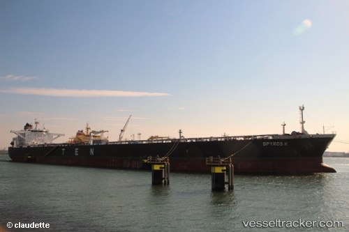
Vessel Spyros K IMO: 9565948, MMSI: 636015119 Crude Oil Tanker
UTC, 17.05366, -50.96913, course: 36, speed: 12.4
UTC, 17.36450, -50.73818, course: 37, speed: 12.1
2026-02-28 04:00:47 UTC, 17.64348, -50.53630, course: 41, speed: 11.9
Live AIS position:
UTC. 344 nm SW of Upper Northfield),
updated 2026-02-28 04:00:47 UTC.
Find the position of the vessel Spyros K on the map. The latter are known coordinates and path.
marine traffic ship tracker show on live map
The current position of vessel Spyros K is 17.64348 lat / -50.53630 lng. Updated: 2026-02-28 04:00:47 UTCCurrently sailing under the flag of Liberia
Spyros K built in 2011 year
Deadweight:
157648 tDetails:
Last coordinates of the vessel:
UTC, 16.61146, -51.29617, course: 39, speed: 11.8UTC, 17.05366, -50.96913, course: 36, speed: 12.4
UTC, 17.36450, -50.73818, course: 37, speed: 12.1
2026-02-28 04:00:47 UTC, 17.64348, -50.53630, course: 41, speed: 11.9