 vesseltracker.com
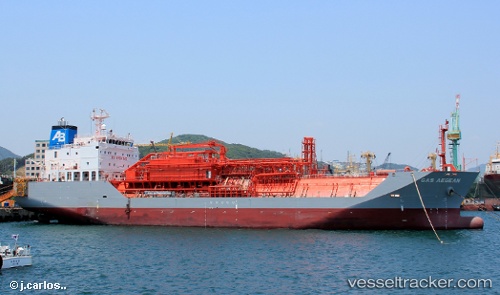
Vessel Gas Aegean IMO: 9545209, MMSI: 636015415 Lpg Tanker
UTC, 37.09997, -6.87487, course: 225, speed: 0.1
UTC, 37.07424, -6.89037, course: 191, speed: 9.4
2026-01-26 23:53:05 UTC, 36.92898, -6.87319, course: 309, speed: 1.9
Live AIS position:
UTC. 15 nm S of Punta Umbría),
updated 2026-01-26 23:53:05 UTC.
Find the position of the vessel Gas Aegean on the map. The latter are known coordinates and path.
marine traffic ship tracker show on live map
The current position of vessel Gas Aegean is 36.92898 lat / -6.87319 lng. Updated: 2026-01-26 23:53:05 UTCCurrently sailing under the flag of Liberia
Gas Aegean built in 2012 year
Deadweight:
10389 tDetails:
Last coordinates of the vessel:
UTC, 37.09997, -6.87490, course: 220, speed: 0UTC, 37.09997, -6.87487, course: 225, speed: 0.1
UTC, 37.07424, -6.89037, course: 191, speed: 9.4
2026-01-26 23:53:05 UTC, 36.92898, -6.87319, course: 309, speed: 1.9