 vesseltracker.com
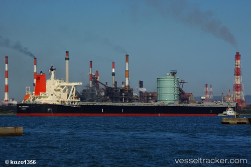
Vessel Azul Horizonte IMO: 9595412, MMSI: 636015632 Bulk Carrier
UTC, -1.43098, 118.85009, course: 20, speed: 11.9
UTC, -1.43098, 118.85009, course: 20, speed: 11.9
2026-02-15 15:32:20 UTC, -1.16755, 118.93725, course: 20, speed: 12.3
Live AIS position:
UTC. 57 nm W of Palu),
updated 2026-02-15 15:32:20 UTC.
Find the position of the vessel Azul Horizonte on the map. The latter are known coordinates and path.
marine traffic ship tracker show on live map
The current position of vessel Azul Horizonte is -1.16755 lat / 118.93725 lng. Updated: 2026-02-15 15:32:20 UTCCurrently sailing under the flag of Liberia
Details:
Last coordinates of the vessel:
UTC, -1.95193, 118.68809, course: 21, speed: 11.9UTC, -1.43098, 118.85009, course: 20, speed: 11.9
UTC, -1.43098, 118.85009, course: 20, speed: 11.9
2026-02-15 15:32:20 UTC, -1.16755, 118.93725, course: 20, speed: 12.3