 vesseltracker.com
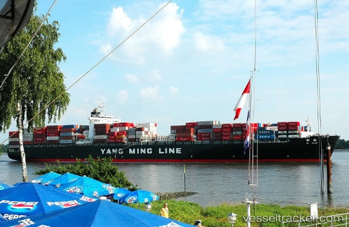
Vessel Ym Plum IMO: 9198264, MMSI: 636018262 Container Ship
UTC, 47.26363, -122.39120, course: 132, speed: 0
UTC, 47.26365, -122.39122, course: 133, speed: 0
2026-02-11 05:23:10 UTC, 47.26358, -122.39120, course: 132, speed: 0
Live AIS position:
UTC. Near Tacoma),
updated 2026-02-11 05:23:10 UTC.
Find the position of the vessel Ym Plum on the map. The latter are known coordinates and path.
marine traffic ship tracker show on live map
The current position of vessel Ym Plum is 47.26358 lat / -122.39120 lng. Updated: 2026-02-11 05:23:10 UTCCurrently sailing under the flag of Liberia
Ym Plum built in 2000 year
Deadweight:
68413 tDetails:
Last coordinates of the vessel:
UTC, 47.44427, -122.40873, course: 149, speed: 16.5UTC, 47.26363, -122.39120, course: 132, speed: 0
UTC, 47.26365, -122.39122, course: 133, speed: 0
2026-02-11 05:23:10 UTC, 47.26358, -122.39120, course: 132, speed: 0