 vesseltracker.com
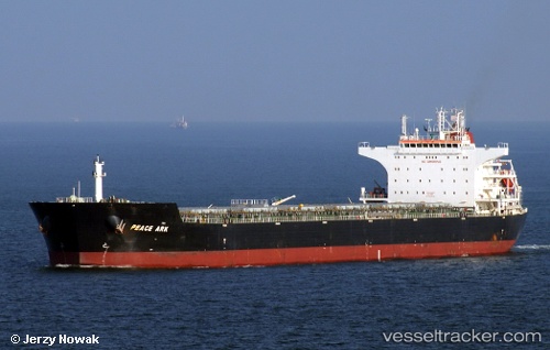
Vessel Peace Ark IMO: 9574406, MMSI: 636018372 Bulk Carrier
UTC, -3.68227, 80.40994, course: 236, speed: 11.6
UTC, -3.92602, 80.03699, course: 236, speed: 11.8
2026-02-07 04:04:24 UTC, -4.15303, 79.68531, course: 234, speed: 12.1
Live AIS position:
UTC. Open sea, approx. 443 nm off the nearest listed port),
updated 2026-02-07 04:04:24 UTC.
Find the position of the vessel Peace Ark on the map. The latter are known coordinates and path.
marine traffic ship tracker show on live map
The current position of vessel Peace Ark is -4.15303 lat / 79.68531 lng. Updated: 2026-02-07 04:04:24 UTCCurrently sailing under the flag of Liberia
Peace Ark built in 2010 year
Deadweight:
93249 tDetails:
Last coordinates of the vessel:
UTC, -3.42926, 80.80661, course: 236, speed: 11.4UTC, -3.68227, 80.40994, course: 236, speed: 11.6
UTC, -3.92602, 80.03699, course: 236, speed: 11.8
2026-02-07 04:04:24 UTC, -4.15303, 79.68531, course: 234, speed: 12.1