 vesseltracker.com
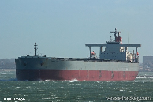
Vessel Cape Med IMO: 9316828, MMSI: 636018475 Bulk Carrier
UTC, -12.54872, 0.40348, course: 146, speed: 8.3
UTC, -12.75135, 0.55473, course: 145, speed: 8.3
2026-02-26 13:27:37 UTC, -12.94008, 0.69003, course: 144, speed: 8.4
Live AIS position:
UTC. 394 nm E of Levelwood),
updated 2026-02-26 13:27:37 UTC.
Find the position of the vessel Cape Med on the map. The latter are known coordinates and path.
marine traffic ship tracker show on live map
The current position of vessel Cape Med is -12.94008 lat / 0.69003 lng. Updated: 2026-02-26 13:27:37 UTCDetails:
Last coordinates of the vessel:
UTC, -12.26910, 0.19862, course: 144, speed: 8.5UTC, -12.54872, 0.40348, course: 146, speed: 8.3
UTC, -12.75135, 0.55473, course: 145, speed: 8.3
2026-02-26 13:27:37 UTC, -12.94008, 0.69003, course: 144, speed: 8.4