 vesseltracker.com
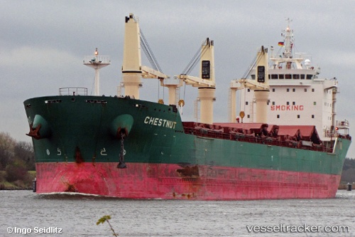
Vessel Chestnut IMO: 9477866, MMSI: 636018939 Bulk Carrier
UTC, -34.71667, -57.86500, course: -1, speed: 0
UTC, -34.74745, -57.64305, course: 103, speed: 11.6
2026-02-28 07:32:56 UTC, -34.87333, -57.34167, course: -1, speed: 12
Live AIS position:
UTC. 16 nm NE of Magdalena),
updated 2026-02-28 07:32:56 UTC.
Find the position of the vessel Chestnut on the map. The latter are known coordinates and path.
marine traffic ship tracker show on live map
The current position of vessel Chestnut is -34.87333 lat / -57.34167 lng. Updated: 2026-02-28 07:32:56 UTCCurrently sailing under the flag of Liberia
Chestnut built in 2010 year
Deadweight:
30809 tDetails:
Last coordinates of the vessel:
UTC, -34.71667, -57.86500, course: -1, speed: 0UTC, -34.71667, -57.86500, course: -1, speed: 0
UTC, -34.74745, -57.64305, course: 103, speed: 11.6
2026-02-28 07:32:56 UTC, -34.87333, -57.34167, course: -1, speed: 12