 vesseltracker.com
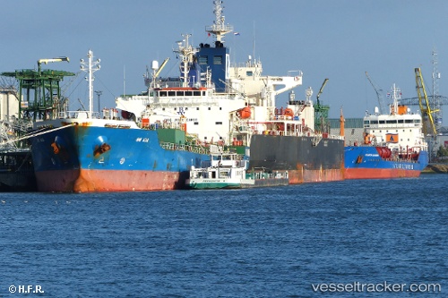
Vessel Chem Mia IMO: 9407093, MMSI: 636019172 Chemical Oil Products Tanker
UTC, 39.21320, -76.53972, course: 231, speed: 0
UTC, 39.11365, -76.39523, course: 180, speed: 11.4
2026-02-06 04:30:59 UTC, 38.55975, -76.43243, course: 169, speed: 12.4
Live AIS position:
UTC. Near Prince Frederick),
updated 2026-02-06 04:30:59 UTC.
Find the position of the vessel Chem Mia on the map. The latter are known coordinates and path.
marine traffic ship tracker show on live map
The current position of vessel Chem Mia is 38.55975 lat / -76.43243 lng. Updated: 2026-02-06 04:30:59 UTCCurrently sailing under the flag of Liberia
Chem Mia built in 2008 year
Deadweight:
19702 tDetails:
Last coordinates of the vessel:
UTC, 39.21320, -76.53970, course: 231, speed: 0UTC, 39.21320, -76.53972, course: 231, speed: 0
UTC, 39.11365, -76.39523, course: 180, speed: 11.4
2026-02-06 04:30:59 UTC, 38.55975, -76.43243, course: 169, speed: 12.4