 vesseltracker.com
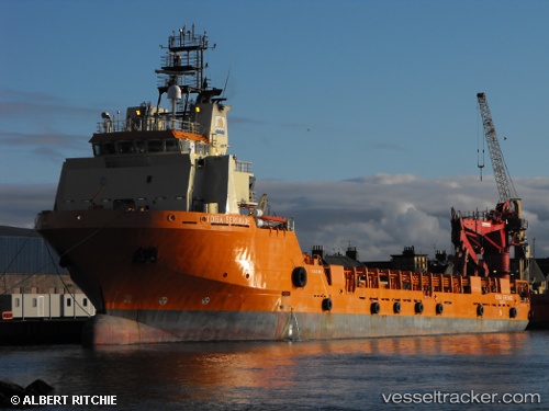
Vessel KARADENIZ POWERSHIP TURKER BEY IMO: 9366641, MMSI: 636019295 Offshore Supply Ship
UTC, -23.29468, -43.04073, course: 171, speed: 10
UTC, -23.55205, -42.98624, course: 165, speed: 10.4
2026-02-04 10:18:01 UTC, -23.96540, -42.87441, course: 165, speed: 9.6
Live AIS position:
UTC. 65 nm S of Santos Dumont Apt/Rio de Janeiro),
updated 2026-02-04 10:18:01 UTC.
Find the position of the vessel KARADENIZ POWERSHIP TURKER BEY on the map. The latter are known coordinates and path.
marine traffic ship tracker show on live map
The current position of vessel KARADENIZ POWERSHIP TURKER BEY is -23.96540 lat / -42.87441 lng. Updated: 2026-02-04 10:18:01 UTCCurrently sailing under the flag of Liberia
KARADENIZ POWERSHIP TURKER BEY built in 2008 year
Deadweight:
4900 tDetails:
Last coordinates of the vessel:
UTC, -23.02586, -43.10528, course: 161, speed: 10.1UTC, -23.29468, -43.04073, course: 171, speed: 10
UTC, -23.55205, -42.98624, course: 165, speed: 10.4
2026-02-04 10:18:01 UTC, -23.96540, -42.87441, course: 165, speed: 9.6