 vesseltracker.com
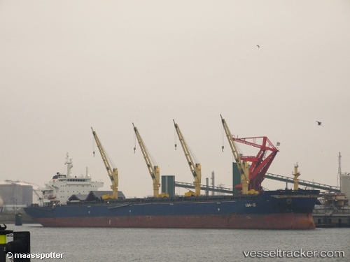
Vessel TANZANITE IMO: 9456147, MMSI: 636019478 Bulk Carrier
UTC, 22.48519, -97.86861, course: 89, speed: 0
UTC, 22.48522, -97.86859, course: 89, speed: 0
2026-03-01 17:49:23 UTC, 22.48524, -97.86863, course: 89, speed: 0
Live AIS position:
UTC. Near Miramar),
updated 2026-03-01 17:49:23 UTC.
Find the position of the vessel TANZANITE on the map. The latter are known coordinates and path.
marine traffic ship tracker show on live map
The current position of vessel TANZANITE is 22.48524 lat / -97.86863 lng. Updated: 2026-03-01 17:49:23 UTCCurrently sailing under the flag of Liberia
TANZANITE built in 2010 year
Deadweight:
56835 tDetails:
Last coordinates of the vessel:
UTC, 22.48518, -97.86864, course: 89, speed: 0UTC, 22.48519, -97.86861, course: 89, speed: 0
UTC, 22.48522, -97.86859, course: 89, speed: 0
2026-03-01 17:49:23 UTC, 22.48524, -97.86863, course: 89, speed: 0