 vesseltracker.com
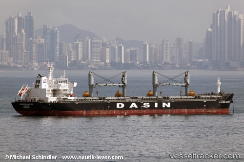
Vessel 'MANDARIN HANTONG' IMO: 9569956, MMSI: 636019619
UTC, 38.76787, 6.51666, course: 104, speed: 11.6
UTC, 38.76787, 6.51666, course: 104, speed: 11.6
2026-02-09 10:35:01 UTC, 38.76787, 6.51666, course: 104, speed: 11.6
Live AIS position:
UTC. 66 nm S of Mirabel),
updated 2026-02-09 10:35:01 UTC.
Find the position of the vessel 'MANDARIN HANTONG' on the map. The latter are known coordinates and path.
marine traffic ship tracker show on live map
The current position of vessel 'MANDARIN HANTONG' is 38.76787 lat / 6.51666 lng. Updated: 2026-02-09 10:35:01 UTCDetails:
Last coordinates of the vessel:
UTC, -20.95288, 15.60199, course: 68, speed: 100.8UTC, 38.76787, 6.51666, course: 104, speed: 11.6
UTC, 38.76787, 6.51666, course: 104, speed: 11.6
2026-02-09 10:35:01 UTC, 38.76787, 6.51666, course: 104, speed: 11.6