.
vessel '636020152' IMO: 9564279, vesseltracker.com
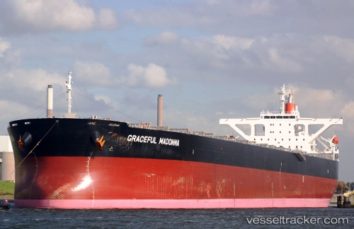
Vessel '636020152' IMO: 9564279, MMSI: 636020152

callsign:
size: x

Live AIS position: UTC. 113 nm E of Puerto Princesa), updated 2026-02-19 07:40:59 UTC.

Find the position of the vessel '636020152' on the map. The latter are known coordinates and path.

marine traffic ship tracker show on live map

The current position of vessel '636020152' is 9.06945 lat / 120.51445 lng. Updated: 2026-02-19 07:40:59 UTC
Details:


Last coordinates of the vessel:
UTC, 8.01736, 120.39950, course: 20, speed: 10
UTC, 8.37797, 120.48783, course: 18, speed: 10
UTC, 8.71827, 120.50638, course: 10, speed: 10.1
2026-02-19 07:40:59 UTC, 9.06945, 120.51445, course: 12, speed: 10


Most frequent ports a vessels calls at '636020152' (636020152):

Sambu, traffic: 12
Singapore, traffic: 6
Sitrah Anchorage, traffic: 2
Vishakhapatnam, traffic: 2
Richards Bay, traffic: 2
Saldanha Bay, traffic: 2
Port Hedland, traffic: 1
Port Louis, traffic: 1
Stadersand, traffic: 1
Port Walcot, traffic: 1
Puerto De La Luz, traffic: 1
Port Headland, traffic: 1
Qingdao, traffic: 1
Samson Point, traffic: 1
Las Palmas, traffic: 1

Link to the map:


Find another ship

'636020152' (636020152) last ports (portcalls and passsages)

Samson Point | 2024-01-08 22:44:51
Selat Lombok | 2024-01-06 12:06:08
Lianyungang | 2023-12-20 03:15:47
Saldanha Bay | 2022-12-29 14:55:00
Port Headland | 2022-10-24 10:26:02
Qingdao | 2022-10-07 13:13:43
Stadersand | 2022-07-18 16:05:01
Puerto De La Luz | 2022-07-07 11:03:00
Saldanha Bay | 2022-06-17 13:47:52
Sitrah Anchorage | 2022-05-25 04:54:05
Sitrah Anchorage | 2022-05-21 04:29:37
Port Louis | 2022-03-07 08:39:46
Vishakhapatnam | 2022-02-18 12:05:03
Richards Bay | 2022-01-28 10:46:18
Singapore | 2022-01-10 18:25:51
Sambu | 2022-01-10 18:15:52
Sambu | 2021-12-10 03:00:51
Singapore | 2021-12-10 02:08:19
Sambu | 2021-12-10 01:55:41