 vesseltracker.com
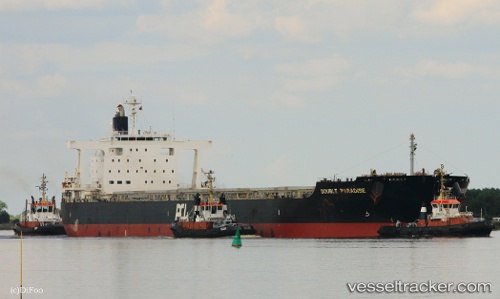
Vessel 636020322 IMO: 9574121, MMSI: 636020322
UTC, -12.16699, 136.63390, course: 46, speed: 0.1
UTC, -12.16568, 136.63348, course: 91, speed: 0
2026-02-06 03:24:21 UTC, -12.16432, 136.63416, course: 134, speed: 0.1
Live AIS position:
UTC. Near Gove Harbor),
updated 2026-02-06 03:24:21 UTC.
Find the position of the vessel 636020322 on the map. The latter are known coordinates and path.
marine traffic ship tracker show on live map
The current position of vessel 636020322 is -12.16432 lat / 136.63416 lng. Updated: 2026-02-06 03:24:21 UTCDetails:
Last coordinates of the vessel:
UTC, -12.16547, 136.63354, course: 97, speed: 0.1UTC, -12.16699, 136.63390, course: 46, speed: 0.1
UTC, -12.16568, 136.63348, course: 91, speed: 0
2026-02-06 03:24:21 UTC, -12.16432, 136.63416, course: 134, speed: 0.1