 vesseltracker.com
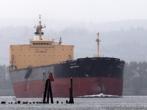
Vessel KC HADONG IMO: 9161687, MMSI: 636020410 Bulk Carrier
UTC, 1.24700, 103.65708, course: 159, speed: 21.7
UTC, 1.24700, 103.65708, course: 159, speed: 21.7
2026-02-03 22:57:10 UTC, 1.24700, 103.65708, course: 159, speed: 21.7
Live AIS position:
UTC. Near JURONG ISLAND),
updated 2026-02-03 22:57:10 UTC.
Find the position of the vessel KC HADONG on the map. The latter are known coordinates and path.
marine traffic ship tracker show on live map
The current position of vessel KC HADONG is 1.24700 lat / 103.65708 lng. Updated: 2026-02-03 22:57:10 UTCCurrently sailing under the flag of Liberia
KC HADONG built in 1997 year
Deadweight:
73762 tDetails:
Last coordinates of the vessel:
UTC, 1.26662, 104.00434, course: 280, speed: 5.8UTC, 1.24700, 103.65708, course: 159, speed: 21.7
UTC, 1.24700, 103.65708, course: 159, speed: 21.7
2026-02-03 22:57:10 UTC, 1.24700, 103.65708, course: 159, speed: 21.7