 vesseltracker.com
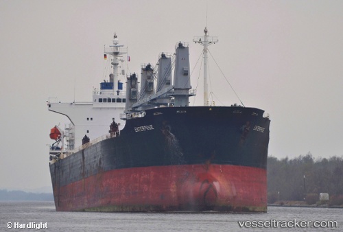
Vessel ENEIDA IMO: 9198381, MMSI: 636020736 Bulk Carrier
UTC, 75.35473, -67.66859, course: 131, speed: 61.5
UTC, 75.35473, -67.66859, course: 131, speed: 61.5
2026-02-18 06:30:06 UTC, 75.35473, -67.66859, course: 131, speed: 61.5
Live AIS position:
UTC. 74 nm S of Thule),
updated 2026-02-18 06:30:06 UTC.
Find the position of the vessel ENEIDA on the map. The latter are known coordinates and path.
marine traffic ship tracker show on live map
The current position of vessel ENEIDA is 75.35473 lat / -67.66859 lng. Updated: 2026-02-18 06:30:06 UTCCurrently sailing under the flag of Liberia
ENEIDA built in 2000 year
Deadweight:
45572 tDetails:
Last coordinates of the vessel:
UTC, 52.52096, 14.97797, course: 0, speed: 31.4UTC, 75.35473, -67.66859, course: 131, speed: 61.5
UTC, 75.35473, -67.66859, course: 131, speed: 61.5
2026-02-18 06:30:06 UTC, 75.35473, -67.66859, course: 131, speed: 61.5