 vesseltracker.com
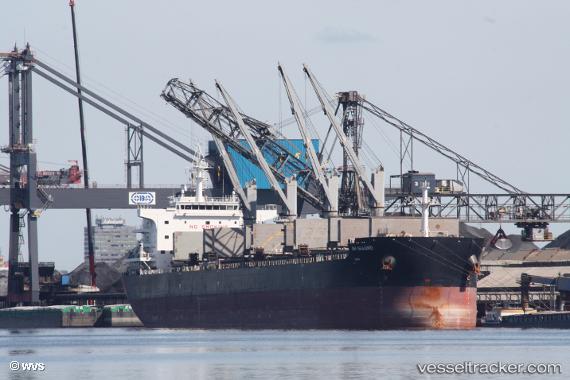
Vessel SEABIRD IMO: 9707687, MMSI: 636020973 Bulk Carrier
UTC, 11.31500, -86.43333, course: -1, speed: 10
UTC, 11.07500, -86.32667, course: -1, speed: 10
2026-01-29 04:14:15 UTC, 10.64183, -86.13237, course: 153, speed: 10.3
Live AIS position:
UTC. 24 nm NW of FLAMINGO),
updated 2026-01-29 04:14:15 UTC.
Find the position of the vessel SEABIRD on the map. The latter are known coordinates and path.
marine traffic ship tracker show on live map
The current position of vessel SEABIRD is 10.64183 lat / -86.13237 lng. Updated: 2026-01-29 04:14:15 UTCCurrently sailing under the flag of Liberia
SEABIRD built in 2016 year
Deadweight:
63553 tDetails:
Last coordinates of the vessel:
UTC, 11.59833, -86.57500, course: -1, speed: 9UTC, 11.31500, -86.43333, course: -1, speed: 10
UTC, 11.07500, -86.32667, course: -1, speed: 10
2026-01-29 04:14:15 UTC, 10.64183, -86.13237, course: 153, speed: 10.3