 vesseltracker.com
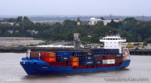
Vessel CANOPUS S IMO: 9076466, MMSI: 636021308 General Cargo Ship
UTC, 42.24423, 33.50432, course: 86, speed: 11.1
UTC, 42.36819, 34.11970, course: -1, speed: 11.2
2026-02-07 15:41:59 UTC, 42.36819, 34.11970, course: -1, speed: 11.2
Live AIS position:
UTC. 28 nm NE of INEBOLU),
updated 2026-02-07 15:41:59 UTC.
Find the position of the vessel CANOPUS S on the map. The latter are known coordinates and path.
marine traffic ship tracker show on live map
The current position of vessel CANOPUS S is 42.36819 lat / 34.11970 lng. Updated: 2026-02-07 15:41:59 UTCCurrently sailing under the flag of Liberia
CANOPUS S built in 1992 year
Deadweight:
5885 tDetails:
Last coordinates of the vessel:
UTC, 42.24423, 33.50432, course: 86, speed: 11.1UTC, 42.24423, 33.50432, course: 86, speed: 11.1
UTC, 42.36819, 34.11970, course: -1, speed: 11.2
2026-02-07 15:41:59 UTC, 42.36819, 34.11970, course: -1, speed: 11.2