 vesseltracker.com
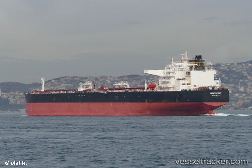
Vessel NANTUCKET IMO: 9600865, MMSI: 636021793 Crude Oil Tanker
UTC, 39.49059, 25.58533, course: 145, speed: 2
UTC, 39.41940, 25.55539, course: 135, speed: 2
2026-02-10 01:57:27 UTC, 39.35068, 25.53759, course: 135, speed: 2.3
Live AIS position:
UTC. 16 nm NW of Sigri Lesvou),
updated 2026-02-10 01:57:27 UTC.
Find the position of the vessel NANTUCKET on the map. The latter are known coordinates and path.
marine traffic ship tracker show on live map
The current position of vessel NANTUCKET is 39.35068 lat / 25.53759 lng. Updated: 2026-02-10 01:57:27 UTCCurrently sailing under the flag of Liberia
NANTUCKET built in 2014 year
Deadweight:
156902 tDetails:
Last coordinates of the vessel:
UTC, 39.56079, 25.62168, course: 151, speed: 1.5UTC, 39.49059, 25.58533, course: 145, speed: 2
UTC, 39.41940, 25.55539, course: 135, speed: 2
2026-02-10 01:57:27 UTC, 39.35068, 25.53759, course: 135, speed: 2.3