 vesseltracker.com
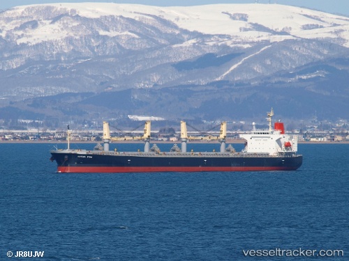
Vessel HONG RUN 16 IMO: 9317420, MMSI: 636022137 Bulk Carrier
UTC, 36.00950, 18.36027, course: 90, speed: 11
UTC, 36.01010, 18.83660, course: 87, speed: 10.8
2026-02-03 14:04:01 UTC, 36.02092, 19.43848, course: 91, speed: 11
Live AIS position:
UTC. 120 nm SW of Methoni),
updated 2026-02-03 14:04:01 UTC.
Find the position of the vessel HONG RUN 16 on the map. The latter are known coordinates and path.
marine traffic ship tracker show on live map
The current position of vessel HONG RUN 16 is 36.02092 lat / 19.43848 lng. Updated: 2026-02-03 14:04:01 UTCCurrently sailing under the flag of Liberia
HONG RUN 16 built in 2006 year
Deadweight:
52900 tDetails:
Last coordinates of the vessel:
UTC, 36.00833, 18.17833, course: -1, speed: 11UTC, 36.00950, 18.36027, course: 90, speed: 11
UTC, 36.01010, 18.83660, course: 87, speed: 10.8
2026-02-03 14:04:01 UTC, 36.02092, 19.43848, course: 91, speed: 11