 vesseltracker.com
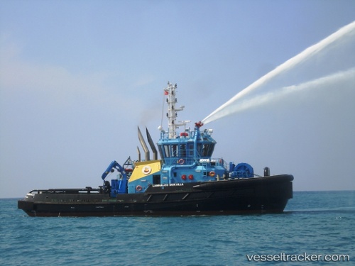
Vessel SL MUKALLA IMO: 9543029, MMSI: 636022199 Tug
UTC, -7.45458, 11.57957, course: 189, speed: 0.3
UTC, -7.45481, 11.58223, course: 224, speed: 0.4
2026-02-25 15:50:22 UTC, -7.45669, 11.57628, course: 216, speed: 0.3
Live AIS position:
UTC. Near CLOV FPSO),
updated 2026-02-25 15:50:22 UTC.
Find the position of the vessel SL MUKALLA on the map. The latter are known coordinates and path.
marine traffic ship tracker show on live map
The current position of vessel SL MUKALLA is -7.45669 lat / 11.57628 lng. Updated: 2026-02-25 15:50:22 UTCCurrently sailing under the flag of Liberia
Details:
Last coordinates of the vessel:
UTC, -7.44659, 11.58204, course: 150, speed: 0.5UTC, -7.45458, 11.57957, course: 189, speed: 0.3
UTC, -7.45481, 11.58223, course: 224, speed: 0.4
2026-02-25 15:50:22 UTC, -7.45669, 11.57628, course: 216, speed: 0.3