 vesseltracker.com
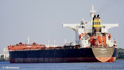
Vessel TAMPA IMO: 9363027, MMSI: 636022375 Bulk Carrier
UTC, 44.52667, -12.74833, course: -1, speed: 10
UTC, 44.28667, -12.80166, course: -1, speed: 9
2026-02-25 15:21:56 UTC, 43.99833, -12.86167, course: -1, speed: 9
Live AIS position:
UTC. 157 nm NW of Bear River City),
updated 2026-02-25 15:21:56 UTC.
Find the position of the vessel TAMPA on the map. The latter are known coordinates and path.
marine traffic ship tracker show on live map
The current position of vessel TAMPA is 43.99833 lat / -12.86167 lng. Updated: 2026-02-25 15:21:56 UTCCurrently sailing under the flag of Liberia
Details:
Last coordinates of the vessel:
UTC, 44.94333, -12.64833, course: -1, speed: 9UTC, 44.52667, -12.74833, course: -1, speed: 10
UTC, 44.28667, -12.80166, course: -1, speed: 9
2026-02-25 15:21:56 UTC, 43.99833, -12.86167, course: -1, speed: 9