 vesseltracker.com
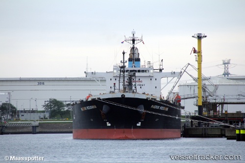
Vessel PRINCESS OGE IMO: 9392389, MMSI: 636022588 Oil Products Tanker
UTC, 5.02353, 8.31498, course: 350, speed: 0
UTC, 5.02353, 8.31498, course: 350, speed: 0
2026-02-24 13:28:51 UTC, 5.02353, 8.31498, course: 350, speed: 0
Live AIS position:
UTC. Near Calabar),
updated 2026-02-24 13:28:51 UTC.
Find the position of the vessel PRINCESS OGE on the map. The latter are known coordinates and path.
marine traffic ship tracker show on live map
The current position of vessel PRINCESS OGE is 5.02353 lat / 8.31498 lng. Updated: 2026-02-24 13:28:51 UTCCurrently sailing under the flag of Liberia
Details:
Last coordinates of the vessel:
UTC, 4.99169, 8.29461, course: 348, speed: 4.2UTC, 5.02353, 8.31498, course: 350, speed: 0
UTC, 5.02353, 8.31498, course: 350, speed: 0
2026-02-24 13:28:51 UTC, 5.02353, 8.31498, course: 350, speed: 0