 vesseltracker.com
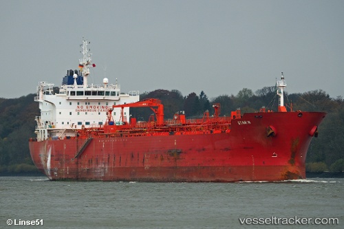
Vessel STAR C IMO: 9411135, MMSI: 636022659 Chemical Oil Products Tanker
UTC, 31.21672, 29.66369, course: 116, speed: 6.3
UTC, 31.21667, 29.68333, course: -1, speed: 1
2026-01-28 12:11:39 UTC, 31.21639, 29.68327, course: 295, speed: 0.5
Live AIS position:
UTC. Near EL DEKHEILA),
updated 2026-01-28 12:11:39 UTC.
Find the position of the vessel STAR C on the map. The latter are known coordinates and path.
marine traffic ship tracker show on live map
The current position of vessel STAR C is 31.21639 lat / 29.68327 lng. Updated: 2026-01-28 12:11:39 UTCCurrently sailing under the flag of Liberia
STAR C built in 2009 year
Deadweight:
37836 tDetails:
Last coordinates of the vessel:
UTC, 31.32551, 29.69818, course: 11, speed: 2UTC, 31.21672, 29.66369, course: 116, speed: 6.3
UTC, 31.21667, 29.68333, course: -1, speed: 1
2026-01-28 12:11:39 UTC, 31.21639, 29.68327, course: 295, speed: 0.5