 vesseltracker.com
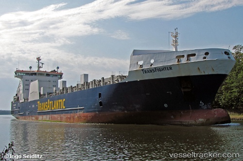
Vessel KPS EMRE BEY IMO: 9216626, MMSI: 636022715 Ro-Ro Cargo
UTC, -2.24271, -79.88035, course: -1, speed: 0
UTC, -2.24271, -79.88035, course: -1, speed: 0
2026-03-04 17:37:44 UTC, -2.24204, -79.88254, course: -1, speed: 0
Live Vessel KPS EMRE BEY Analytics (details, animations, etc.)
Live AIS position: UTC. Near Guayaquil), updated 2026-03-04 17:37:44 UTC.Find the position of the vessel KPS EMRE BEY on the map. The latter are known coordinates and path.
marine traffic ship tracker show on live map
The current position of vessel KPS EMRE BEY is -2.24204 lat / -79.88254 lng. Updated: 2026-03-04 17:37:44 UTCCurrently sailing under the flag of Liberia
Details:
Last coordinates of the vessel:
UTC, -2.24271, -79.88035, course: -1, speed: 0UTC, -2.24271, -79.88035, course: -1, speed: 0
UTC, -2.24271, -79.88035, course: -1, speed: 0
2026-03-04 17:37:44 UTC, -2.24204, -79.88254, course: -1, speed: 0