 vesseltracker.com
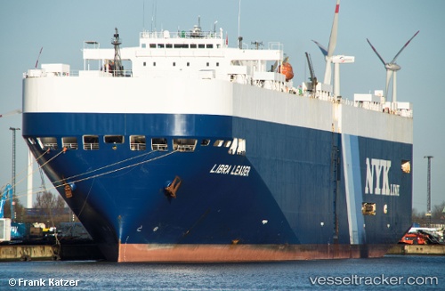
Vessel LIBRA LEADER IMO: 9174490, MMSI: 636022754 Vehicles Carrier
UTC, 35.26028, 147.17809, course: 252, speed: 15.7
UTC, 35.07667, 146.46500, course: -1, speed: 14
2026-02-26 03:37:59 UTC, 34.90500, 145.80499, course: -1, speed: 15
Live AIS position:
UTC. 132 nm SE of Santa Venera),
updated 2026-02-26 03:37:59 UTC.
Find the position of the vessel LIBRA LEADER on the map. The latter are known coordinates and path.
marine traffic ship tracker show on live map
The current position of vessel LIBRA LEADER is 34.90500 lat / 145.80499 lng. Updated: 2026-02-26 03:37:59 UTCCurrently sailing under the flag of Liberia
Details:
Last coordinates of the vessel:
UTC, 35.37774, 147.65173, course: 255, speed: 15.3UTC, 35.26028, 147.17809, course: 252, speed: 15.7
UTC, 35.07667, 146.46500, course: -1, speed: 14
2026-02-26 03:37:59 UTC, 34.90500, 145.80499, course: -1, speed: 15