 vesseltracker.com
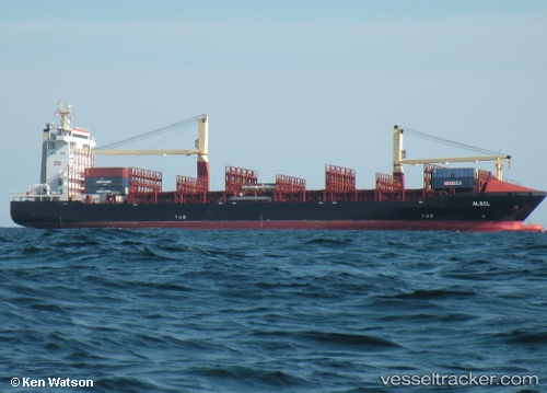
Vessel LM ARES IMO: 9339612, MMSI: 636024209 Container Ship
UTC, 17.97756, -76.82969, course: -1, speed: 0
UTC, 17.97754, -76.82966, course: -1, speed: 0
2026-02-26 11:30:53 UTC, 17.97755, -76.82971, course: -1, speed: 0
Live AIS position:
UTC. Near Kingston Tinson Airport),
updated 2026-02-26 11:30:53 UTC.
Find the position of the vessel LM ARES on the map. The latter are known coordinates and path.
marine traffic ship tracker show on live map
The current position of vessel LM ARES is 17.97755 lat / -76.82971 lng. Updated: 2026-02-26 11:30:53 UTCCurrently sailing under the flag of Liberia
Details:
Last coordinates of the vessel:
UTC, 17.97756, -76.82968, course: 132, speed: 0UTC, 17.97756, -76.82969, course: -1, speed: 0
UTC, 17.97754, -76.82966, course: -1, speed: 0
2026-02-26 11:30:53 UTC, 17.97755, -76.82971, course: -1, speed: 0