 vesseltracker.com
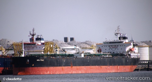
Vessel Meltemi I IMO: 9298741, MMSI: 636024397 Crude Oil Tanker
UTC, 6.10173, 95.63358, course: 97, speed: 10.6
UTC, 6.02392, 96.02840, course: 103, speed: 11.4
2026-02-19 02:15:31 UTC, 5.91987, 96.40738, course: 106, speed: 11.1
Live AIS position:
UTC. 55 nm NW of Krueng Geukueh),
updated 2026-02-19 02:15:31 UTC.
Find the position of the vessel Meltemi I on the map. The latter are known coordinates and path.
marine traffic ship tracker show on live map
The current position of vessel Meltemi I is 5.91987 lat / 96.40738 lng. Updated: 2026-02-19 02:15:31 UTCCurrently sailing under the flag of Liberia
Meltemi I built in 0 year
Deadweight:
0 tDetails:
Last coordinates of the vessel:
UTC, 6.15215, 95.37707, course: 98, speed: 11UTC, 6.10173, 95.63358, course: 97, speed: 10.6
UTC, 6.02392, 96.02840, course: 103, speed: 11.4
2026-02-19 02:15:31 UTC, 5.91987, 96.40738, course: 106, speed: 11.1