 vesseltracker.com
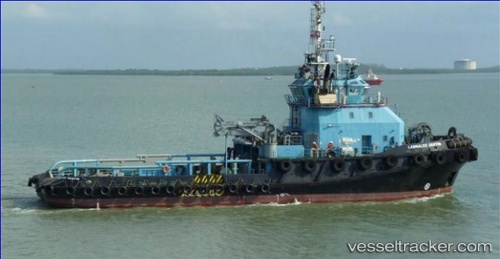
Vessel SL GRIFFIN IMO: 9490272, MMSI: 636025249 Tug
UTC, 8.02021, -56.93488, course: 63, speed: 1.8
UTC, 8.00833, -56.94333, course: -1, speed: 4
2026-02-27 11:30:54 UTC, 8.00763, -56.92754, course: 245, speed: 0.7
Live AIS position:
UTC. 97 nm NE of Enmore),
updated 2026-02-27 11:30:54 UTC.
Find the position of the vessel SL GRIFFIN on the map. The latter are known coordinates and path.
marine traffic ship tracker show on live map
The current position of vessel SL GRIFFIN is 8.00763 lat / -56.92754 lng. Updated: 2026-02-27 11:30:54 UTCCurrently sailing under the flag of Liberia
Details:
Last coordinates of the vessel:
UTC, 8.03102, -56.90489, course: 65, speed: 1.7UTC, 8.02021, -56.93488, course: 63, speed: 1.8
UTC, 8.00833, -56.94333, course: -1, speed: 4
2026-02-27 11:30:54 UTC, 8.00763, -56.92754, course: 245, speed: 0.7