 vesseltracker.com
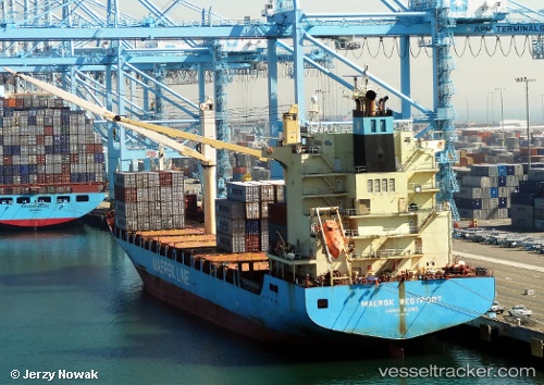
Vessel Maersk Westport IMO: 9387463, MMSI: 636092826 Container Ship
UTC, 17.95333, -16.12167, course: -1, speed: 0
UTC, 17.95447, -16.12166, course: 30, speed: 0.2
2026-01-28 15:55:38 UTC, 17.95333, -16.11833, course: -1, speed: 0
Live AIS position:
UTC. Near Nouakchott),
updated 2026-01-28 15:55:38 UTC.
Find the position of the vessel Maersk Westport on the map. The latter are known coordinates and path.
marine traffic ship tracker show on live map
The current position of vessel Maersk Westport is 17.95333 lat / -16.11833 lng. Updated: 2026-01-28 15:55:38 UTCDetails:
Last coordinates of the vessel:
UTC, 17.95333, -16.12167, course: -1, speed: 0UTC, 17.95333, -16.12167, course: -1, speed: 0
UTC, 17.95447, -16.12166, course: 30, speed: 0.2
2026-01-28 15:55:38 UTC, 17.95333, -16.11833, course: -1, speed: 0