 vesseltracker.com
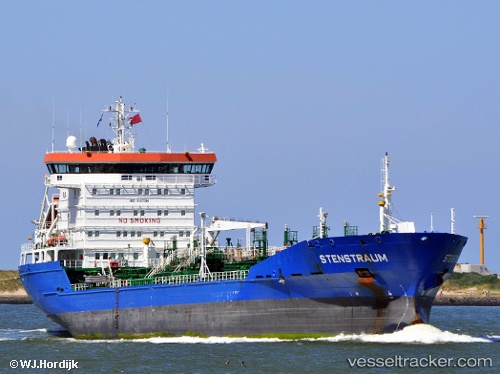
Vessel STENSTRAUM IMO: 9187394, MMSI: 636092973 Chemical/Oil Products Tanker
UTC, 1.42188, -11.15289, course: 135, speed: 1.5
UTC, 1.42188, -11.15289, course: 135, speed: 1.5
2026-02-03 18:12:10 UTC, 1.42188, -11.15289, course: 135, speed: 1.5
Live AIS position:
UTC. 249 nm SW of Greenville),
updated 2026-02-03 18:12:10 UTC.
Find the position of the vessel STENSTRAUM on the map. The latter are known coordinates and path.
marine traffic ship tracker show on live map
The current position of vessel STENSTRAUM is 1.42188 lat / -11.15289 lng. Updated: 2026-02-03 18:12:10 UTCCurrently sailing under the flag of Liberia
STENSTRAUM built in 2001 year
Deadweight:
13677 tDetails:
Last coordinates of the vessel:
UTC, 1.42188, -11.15289, course: 135, speed: 1.5UTC, 1.42188, -11.15289, course: 135, speed: 1.5
UTC, 1.42188, -11.15289, course: 135, speed: 1.5
2026-02-03 18:12:10 UTC, 1.42188, -11.15289, course: 135, speed: 1.5