 vesseltracker.com
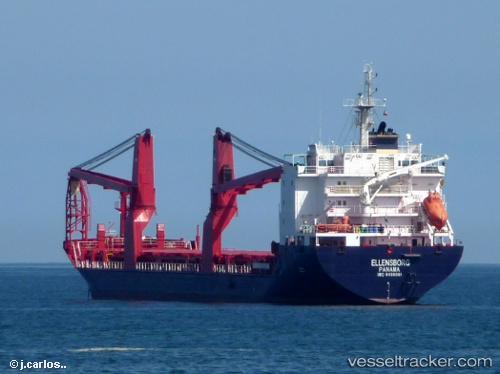
Vessel ELLENSBORG IMO: 9488061, MMSI: 636092992 General Cargo Ship
UTC, -0.00004, 73.23397, course: -1, speed: 97.5
UTC, -0.00004, 73.23397, course: -1, speed: 97.5
UTC, 10.32754, 107.05585, course: 351, speed: 9.4
UTC, 10.32754, 107.05585, course: 351, speed: 9.4
2026-02-16 01:24:58 UTC, 10.32754, 107.05585, course: 351, speed: 9.4
Live AIS position:
UTC. Near Cape St. Jacques),
updated 2026-02-16 01:24:58 UTC.
Find the position of the vessel ELLENSBORG on the map. The latter are known coordinates and path.
marine traffic ship tracker show on live map
The current position of vessel ELLENSBORG is 10.32754 lat / 107.05585 lng. Updated: 2026-02-16 01:24:58 UTCCurrently sailing under the flag of Liberia
ELLENSBORG built in 2011 year
Deadweight:
12731 tDetails:
Last coordinates of the vessel:
UTC, -0.00004, 73.23397, course: -1, speed: 97.5UTC, -0.00004, 73.23397, course: -1, speed: 97.5
UTC, -0.00004, 73.23397, course: -1, speed: 97.5
UTC, 10.32754, 107.05585, course: 351, speed: 9.4
UTC, 10.32754, 107.05585, course: 351, speed: 9.4
2026-02-16 01:24:58 UTC, 10.32754, 107.05585, course: 351, speed: 9.4