 vesseltracker.com
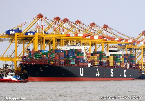
Vessel JEBEL ALI IMO: 9525936, MMSI: 636093174 Container Ship
UTC, 5.41825, 106.74413, course: 215, speed: 13.3
UTC, 5.19542, 106.57412, course: 213, speed: 13.4
2026-02-28 05:22:06 UTC, 4.87901, 106.36784, course: 213, speed: 13.8
Live AIS position:
UTC. 26 nm E of Kakap Natuna Terminal),
updated 2026-02-28 05:22:06 UTC.
Find the position of the vessel JEBEL ALI on the map. The latter are known coordinates and path.
marine traffic ship tracker show on live map
The current position of vessel JEBEL ALI is 4.87901 lat / 106.36784 lng. Updated: 2026-02-28 05:22:06 UTCCurrently sailing under the flag of Liberia
Details:
Last coordinates of the vessel:
UTC, 5.77513, 107.05352, course: 230, speed: 12.9UTC, 5.41825, 106.74413, course: 215, speed: 13.3
UTC, 5.19542, 106.57412, course: 213, speed: 13.4
2026-02-28 05:22:06 UTC, 4.87901, 106.36784, course: 213, speed: 13.8