 vesseltracker.com
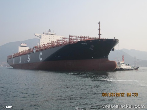
Vessel TAYMA EXPRESS IMO: 9525895, MMSI: 636093175 Cargo A
UTC, 2.29736, 54.67179, course: 37, speed: 19.7
UTC, 3.06555, 55.17068, course: 38, speed: 20
2026-02-26 07:46:27 UTC, 3.47913, 55.44475, course: 35, speed: 20.5
Live AIS position:
UTC. Open sea, approx. 511 nm off the nearest listed port),
updated 2026-02-26 07:46:27 UTC.
Find the position of the vessel TAYMA EXPRESS on the map. The latter are known coordinates and path.
marine traffic ship tracker show on live map
The current position of vessel TAYMA EXPRESS is 3.47913 lat / 55.44475 lng. Updated: 2026-02-26 07:46:27 UTCCurrently sailing under the flag of Liberia
Details:
Last coordinates of the vessel:
UTC, 1.99188, 54.46666, course: 37, speed: 19.6UTC, 2.29736, 54.67179, course: 37, speed: 19.7
UTC, 3.06555, 55.17068, course: 38, speed: 20
2026-02-26 07:46:27 UTC, 3.47913, 55.44475, course: 35, speed: 20.5