 vesseltracker.com
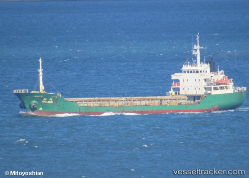
Vessel Silver Way IMO: 8858855, MMSI: 667001620 General Cargo Ship
UTC, 42.82728, 132.93263, course: 143, speed: 0
UTC, 42.82733, 132.93335, course: 195, speed: 0.3
2026-02-04 05:16:49 UTC, 42.82677, 132.93420, course: 263, speed: 0.4
Live AIS position:
UTC. Near Nakhodka),
updated 2026-02-04 05:16:49 UTC.
Find the position of the vessel Silver Way on the map. The latter are known coordinates and path.
marine traffic ship tracker show on live map
The current position of vessel Silver Way is 42.82677 lat / 132.93420 lng. Updated: 2026-02-04 05:16:49 UTCCurrently sailing under the flag of Sierra Leone
Details:
Last coordinates of the vessel:
UTC, 42.82597, 132.93213, course: 38, speed: 0UTC, 42.82728, 132.93263, course: 143, speed: 0
UTC, 42.82733, 132.93335, course: 195, speed: 0.3
2026-02-04 05:16:49 UTC, 42.82677, 132.93420, course: 263, speed: 0.4