 vesseltracker.com
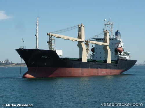
Vessel HORUS IMO: 9039975, MMSI: 667002382 General Cargo
UTC, 2.69111, 9.73628, course: -1, speed: 0.1
UTC, 2.69066, 9.73602, course: -1, speed: 0.1
2026-02-28 09:26:49 UTC, 2.69133, 9.73706, course: -1, speed: 0.1
Live AIS position:
UTC. Near Ebomé Terminal),
updated 2026-02-28 09:26:49 UTC.
Find the position of the vessel HORUS on the map. The latter are known coordinates and path.
marine traffic ship tracker show on live map
The current position of vessel HORUS is 2.69133 lat / 9.73706 lng. Updated: 2026-02-28 09:26:49 UTCCurrently sailing under the flag of Sierra Leone
Details:
Last coordinates of the vessel:
UTC, 2.69132, 9.73658, course: -1, speed: 0.1UTC, 2.69111, 9.73628, course: -1, speed: 0.1
UTC, 2.69066, 9.73602, course: -1, speed: 0.1
2026-02-28 09:26:49 UTC, 2.69133, 9.73706, course: -1, speed: 0.1