 vesseltracker.com
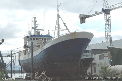
Vessel Ringaskjaer IMO: 6700638, MMSI: 258522000 Fishing Vessel
UTC, 60.39811, 5.31406, course: 195, speed: 0
UTC, 60.37624, 5.16803, course: 192, speed: 5.9
2026-02-26 02:05:31 UTC, 60.18145, 5.16407, course: 232, speed: 7.8
Live AIS position:
UTC. Near Torangsvåg),
updated 2026-02-26 02:05:31 UTC.
Find the position of the vessel Ringaskjaer on the map. The latter are known coordinates and path.
marine traffic ship tracker show on live map
The current position of vessel Ringaskjaer is 60.18145 lat / 5.16407 lng. Updated: 2026-02-26 02:05:31 UTCDetails:
Last coordinates of the vessel:
UTC, 60.39815, 5.31411, course: 193, speed: 0UTC, 60.39811, 5.31406, course: 195, speed: 0
UTC, 60.37624, 5.16803, course: 192, speed: 5.9
2026-02-26 02:05:31 UTC, 60.18145, 5.16407, course: 232, speed: 7.8