 vesseltracker.com
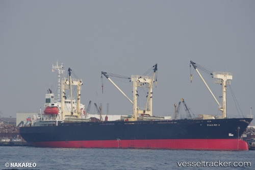
Vessel Khaled A IMO: 9010046, MMSI: 671025100 General Cargo Ship
UTC, 29.64789, 32.34087, course: -1, speed: 0
UTC, 29.64793, 32.34084, course: -1, speed: 0
2026-02-08 19:34:13 UTC, 29.64786, 32.34088, course: -1, speed: 0
Live AIS position:
UTC. Near Sokhna Port),
updated 2026-02-08 19:34:13 UTC.
Find the position of the vessel Khaled A on the map. The latter are known coordinates and path.
marine traffic ship tracker show on live map
The current position of vessel Khaled A is 29.64786 lat / 32.34088 lng. Updated: 2026-02-08 19:34:13 UTCDetails:
Last coordinates of the vessel:
UTC, 29.64791, 32.34084, course: -1, speed: 0UTC, 29.64789, 32.34087, course: -1, speed: 0
UTC, 29.64793, 32.34084, course: -1, speed: 0
2026-02-08 19:34:13 UTC, 29.64786, 32.34088, course: -1, speed: 0