 vesseltracker.com
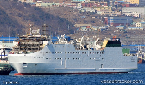
Vessel Mapinduzi Ii IMO: 9708485, MMSI: 677015400 Passenger General Cargo Ship
UTC, -6.15561, 39.18511, course: -1, speed: 0.3
UTC, -6.15561, 39.18511, course: -1, speed: 0.3
UTC, -6.15540, 39.18530, course: -1, speed: 0.5
UTC, -6.15540, 39.18530, course: -1, speed: 0.5
2026-02-13 06:10:27 UTC, -6.15540, 39.18530, course: -1, speed: 0.5
Live AIS position:
UTC. Near Zanzibar),
updated 2026-02-13 06:10:27 UTC.
Find the position of the vessel Mapinduzi Ii on the map. The latter are known coordinates and path.
marine traffic ship tracker show on live map
The current position of vessel Mapinduzi Ii is -6.15540 lat / 39.18530 lng. Updated: 2026-02-13 06:10:27 UTCDetails:
Last coordinates of the vessel:
UTC, -6.15561, 39.18511, course: -1, speed: 0.3UTC, -6.15561, 39.18511, course: -1, speed: 0.3
UTC, -6.15561, 39.18511, course: -1, speed: 0.3
UTC, -6.15540, 39.18530, course: -1, speed: 0.5
UTC, -6.15540, 39.18530, course: -1, speed: 0.5
2026-02-13 06:10:27 UTC, -6.15540, 39.18530, course: -1, speed: 0.5