 vesseltracker.com
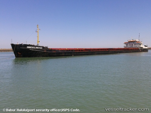
Vessel DOBRYNYA NIKITICH IMO: 8942905, MMSI: 677043600 General Cargo Ship
UTC, 22.43958, 91.72605, course: -1, speed: 0
UTC, 22.43958, 91.72605, course: -1, speed: 0
2026-02-04 07:57:59 UTC, 22.43958, 91.72605, course: -1, speed: 0
Live AIS position:
UTC. Near Chattogram),
updated 2026-02-04 07:57:59 UTC.
Find the position of the vessel DOBRYNYA NIKITICH on the map. The latter are known coordinates and path.
marine traffic ship tracker show on live map
The current position of vessel DOBRYNYA NIKITICH is 22.43958 lat / 91.72605 lng. Updated: 2026-02-04 07:57:59 UTCCurrently sailing under the flag of Tanzania
DOBRYNYA NIKITICH built in 1970 year
Deadweight:
5180 tDetails:
Last coordinates of the vessel:
UTC, 22.26093, 91.69190, course: -1, speed: 11.3UTC, 22.43958, 91.72605, course: -1, speed: 0
UTC, 22.43958, 91.72605, course: -1, speed: 0
2026-02-04 07:57:59 UTC, 22.43958, 91.72605, course: -1, speed: 0