 vesseltracker.com
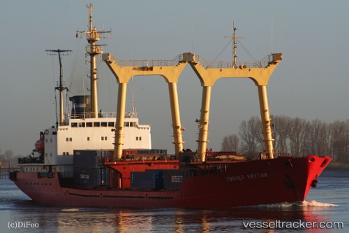
Vessel Amr R IMO: 7646750, MMSI: 677071600 Multi Purpose Carrier
UTC, 36.89481, 7.76471, course: 271, speed: 0
UTC, 36.89482, 7.76473, course: 271, speed: 0
2026-01-28 00:28:37 UTC, 36.89483, 7.76471, course: 271, speed: 0
Live AIS position:
UTC. Near Annaba),
updated 2026-01-28 00:28:37 UTC.
Find the position of the vessel Amr R on the map. The latter are known coordinates and path.
marine traffic ship tracker show on live map
The current position of vessel Amr R is 36.89483 lat / 7.76471 lng. Updated: 2026-01-28 00:28:37 UTCDetails:
Last coordinates of the vessel:
UTC, 36.89482, 7.76473, course: 271, speed: 0UTC, 36.89481, 7.76471, course: 271, speed: 0
UTC, 36.89482, 7.76473, course: 271, speed: 0
2026-01-28 00:28:37 UTC, 36.89483, 7.76471, course: 271, speed: 0