 vesseltracker.com
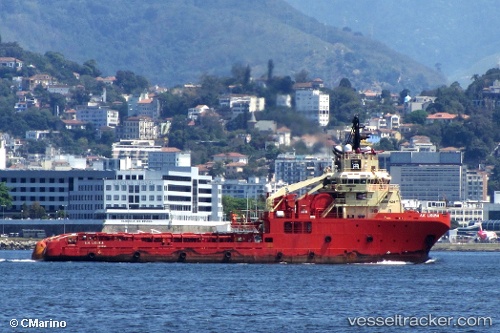
Vessel A. H. LIGURIA IMO: 9381495, MMSI: 710005167 Offshore Tug/Supply Ship
UTC, -22.38288, -40.11179, course: 19, speed: 0.4
UTC, -22.38163, -40.10921, course: 8, speed: 0.6
2026-02-09 03:33:34 UTC, -22.37167, -40.11333, course: -1, speed: 1
Live AIS position:
UTC. 24 nm NE of Fluminense FPSO),
updated 2026-02-09 03:33:34 UTC.
Find the position of the vessel A. H. LIGURIA on the map. The latter are known coordinates and path.
marine traffic ship tracker show on live map
The current position of vessel A. H. LIGURIA is -22.37167 lat / -40.11333 lng. Updated: 2026-02-09 03:33:34 UTCCurrently sailing under the flag of Brazil
A. H. LIGURIA built in 2008 year
Deadweight:
2945 tDetails:
Last coordinates of the vessel:
UTC, -22.39333, -40.10667, course: -1, speed: 0UTC, -22.38288, -40.11179, course: 19, speed: 0.4
UTC, -22.38163, -40.10921, course: 8, speed: 0.6
2026-02-09 03:33:34 UTC, -22.37167, -40.11333, course: -1, speed: 1