 vesseltracker.com
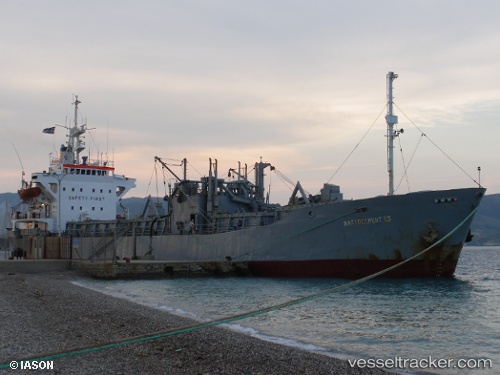
Vessel Angelos K IMO: 7106188, MMSI: 377263000 Cement Carrier
UTC, 31.82786, 34.64699, course: 282, speed: 0
UTC, 31.82785, 34.64700, course: 282, speed: 0
2026-02-14 17:31:48 UTC, 31.82786, 34.64699, course: 282, speed: 0.1
Live AIS position:
UTC. Near Ashdod Bonded),
updated 2026-02-14 17:31:48 UTC.
Find the position of the vessel Angelos K on the map. The latter are known coordinates and path.
marine traffic ship tracker show on live map
The current position of vessel Angelos K is 31.82786 lat / 34.64699 lng. Updated: 2026-02-14 17:31:48 UTCDetails:
Last coordinates of the vessel:
UTC, 31.82787, 34.64700, course: 282, speed: 0.1UTC, 31.82786, 34.64699, course: 282, speed: 0
UTC, 31.82785, 34.64700, course: 282, speed: 0
2026-02-14 17:31:48 UTC, 31.82786, 34.64699, course: 282, speed: 0.1