 vesseltracker.com
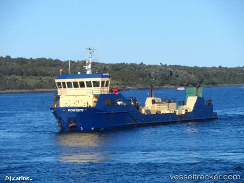
Vessel Forseti IMO: 9534092, MMSI: 725000662 Fish Carrier
UTC, -41.75833, -72.99546, course: 344, speed: 9.7
UTC, -41.62241, -73.02877, course: 354, speed: 10.4
2026-02-09 15:29:18 UTC, -41.52125, -73.03242, course: 65, speed: 0.1
Live AIS position:
UTC. Near Puerto Montt),
updated 2026-02-09 15:29:18 UTC.
Find the position of the vessel Forseti on the map. The latter are known coordinates and path.
marine traffic ship tracker show on live map
The current position of vessel Forseti is -41.52125 lat / -73.03242 lng. Updated: 2026-02-09 15:29:18 UTCDetails:
Last coordinates of the vessel:
UTC, -42.16172, -72.99230, course: 4, speed: 10.3UTC, -41.75833, -72.99546, course: 344, speed: 9.7
UTC, -41.62241, -73.02877, course: 354, speed: 10.4
2026-02-09 15:29:18 UTC, -41.52125, -73.03242, course: 65, speed: 0.1