 vesseltracker.com
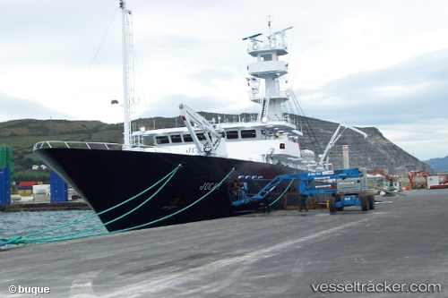
Vessel Jocay IMO: 9710983, MMSI: 735059287 Fishing Vessel
UTC, -0.93136, -80.72124, course: 79, speed: 0
UTC, -0.93137, -80.72126, course: 80, speed: 0
2026-02-28 13:59:02 UTC, -0.93141, -80.72124, course: 79, speed: 0
Live AIS position:
UTC. Near MANTA),
updated 2026-02-28 13:59:02 UTC.
Find the position of the vessel Jocay on the map. The latter are known coordinates and path.
marine traffic ship tracker show on live map
The current position of vessel Jocay is -0.93141 lat / -80.72124 lng. Updated: 2026-02-28 13:59:02 UTCDetails:
Last coordinates of the vessel:
UTC, -0.93137, -80.72120, course: 80, speed: 0UTC, -0.93136, -80.72124, course: 79, speed: 0
UTC, -0.93137, -80.72126, course: 80, speed: 0
2026-02-28 13:59:02 UTC, -0.93141, -80.72124, course: 79, speed: 0