 vesseltracker.com
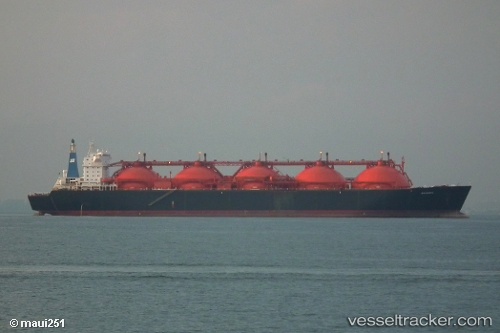
Vessel Gandria IMO: 7361934, MMSI: 538004664 Lng Tanker
UTC, 1.20820, 103.68967, course: -1, speed: 9.1
2026-02-04 07:14:20 UTC, 1.20820, 103.68967, course: -1, speed: 9.1
Live AIS position:
UTC. Near JURONG ISLAND),
updated 2026-02-04 07:14:20 UTC.
Find the position of the vessel Gandria on the map. The latter are known coordinates and path.
marine traffic ship tracker show on live map
The current position of vessel Gandria is 1.20820 lat / 103.68967 lng. Updated: 2026-02-04 07:14:20 UTCDetails:
Last coordinates of the vessel:
UTC, 1.20820, 103.68967, course: -1, speed: 9.1UTC, 1.20820, 103.68967, course: -1, speed: 9.1
2026-02-04 07:14:20 UTC, 1.20820, 103.68967, course: -1, speed: 9.1