 vesseltracker.com
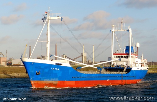
Vessel Layla IMO: 7420936, MMSI: 304716000 General Cargo Ship
UTC, -36.02656, 159.47467, course: 315, speed: 1.4
UTC, -36.01323, 159.40210, course: 319, speed: 1.5
2026-02-25 15:44:54 UTC, -35.99897, 159.35007, course: 321, speed: 1.4
Live AIS position:
UTC. 369 nm SE of Gladesville),
updated 2026-02-25 15:44:54 UTC.
Find the position of the vessel Layla on the map. The latter are known coordinates and path.
marine traffic ship tracker show on live map
The current position of vessel Layla is -35.99897 lat / 159.35007 lng. Updated: 2026-02-25 15:44:54 UTCDetails:
Last coordinates of the vessel:
UTC, -36.03346, 159.52629, course: 312, speed: 1.4UTC, -36.02656, 159.47467, course: 315, speed: 1.4
UTC, -36.01323, 159.40210, course: 319, speed: 1.5
2026-02-25 15:44:54 UTC, -35.99897, 159.35007, course: 321, speed: 1.4