 vesseltracker.com
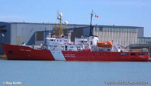
Vessel Cape Roger IMO: 7503180, MMSI: 316012000 Fishing Support Vessel
UTC, 44.55833, -63.95333, course: -1, speed: 0
UTC, 44.55833, -63.95167, course: -1, speed: 0
2026-02-18 14:00:35 UTC, 44.55833, -63.95167, course: -1, speed: 0
Live AIS position:
UTC. Near Hacketts Cove),
updated 2026-02-18 14:00:35 UTC.
Find the position of the vessel Cape Roger on the map. The latter are known coordinates and path.
marine traffic ship tracker show on live map
The current position of vessel Cape Roger is 44.55833 lat / -63.95167 lng. Updated: 2026-02-18 14:00:35 UTCCurrently sailing under the flag of Canada
Cape Roger built in 1977 year
Deadweight:
528 tDetails:
Last coordinates of the vessel:
UTC, 44.55833, -63.95333, course: -1, speed: 0UTC, 44.55833, -63.95333, course: -1, speed: 0
UTC, 44.55833, -63.95167, course: -1, speed: 0
2026-02-18 14:00:35 UTC, 44.55833, -63.95167, course: -1, speed: 0