 vesseltracker.com
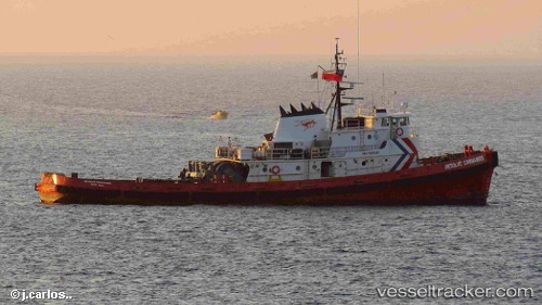
Vessel Resolve Commander IMO: 7505982, MMSI: 577016000 Tug
UTC, 48.59504, -44.90196, course: -1, speed: 45.1
UTC, 48.59504, -44.90196, course: -1, speed: 45.1
2026-02-16 03:33:29 UTC, 48.59504, -44.90196, course: -1, speed: 45.1
Live AIS position:
UTC. 28 nm NW of Baroville),
updated 2026-02-16 03:33:29 UTC.
Find the position of the vessel Resolve Commander on the map. The latter are known coordinates and path.
marine traffic ship tracker show on live map
The current position of vessel Resolve Commander is 48.59504 lat / -44.90196 lng. Updated: 2026-02-16 03:33:29 UTCDetails:
Last coordinates of the vessel:
UTC, 48.59504, -44.90196, course: -1, speed: 45.1UTC, 48.59504, -44.90196, course: -1, speed: 45.1
UTC, 48.59504, -44.90196, course: -1, speed: 45.1
2026-02-16 03:33:29 UTC, 48.59504, -44.90196, course: -1, speed: 45.1