 vesseltracker.com
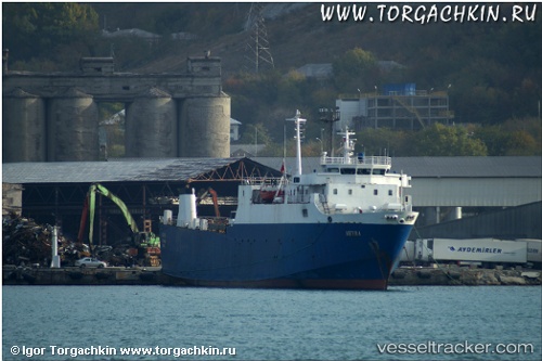
Vessel MEYRA IMO: 7600017, MMSI: 341185000 Ro-Ro Cargo Ship
Live AIS position:
UTC. Near Port Sudan),
updated 2024-08-21 13:00:01 UTC.
Find the position of the vessel MEYRA on the map. The latter are known coordinates and path.
marine traffic ship tracker show on live map
The current position of vessel MEYRA is 19.66198 lat / 37.23716 lng. Updated: 2024-08-21 13:00:01 UTCCurrently sailing under the flag of St.Kitts and Nevis
MEYRA built in 1978 year
Deadweight:
1617 tDetails:
Last coordinates of the vessel:
2024-08-21 13:00:01 UTC, 19.66198, 37.23716, course: -1, speed: 0.3