 vesseltracker.com
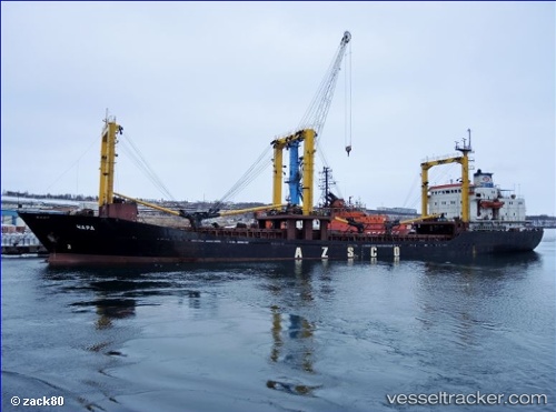
Vessel CHARA IMO: 7628265, MMSI: 273441770 General Cargo
UTC, 43.06643, 131.97252, course: 357, speed: 0.2
UTC, 43.06643, 131.97252, course: 357, speed: 0.2
2026-01-31 06:20:02 UTC, 43.06643, 131.97252, course: 357, speed: 0.2
Live AIS position:
UTC. Near Dalzavod),
updated 2026-01-31 06:20:02 UTC.
Find the position of the vessel CHARA on the map. The latter are known coordinates and path.
marine traffic ship tracker show on live map
The current position of vessel CHARA is 43.06643 lat / 131.97252 lng. Updated: 2026-01-31 06:20:02 UTCCurrently sailing under the flag of Russia
CHARA built in 1978 year
Deadweight:
6553 tDetails:
Last coordinates of the vessel:
UTC, 43.06652, 131.97200, course: 22, speed: 0UTC, 43.06643, 131.97252, course: 357, speed: 0.2
UTC, 43.06643, 131.97252, course: 357, speed: 0.2
2026-01-31 06:20:02 UTC, 43.06643, 131.97252, course: 357, speed: 0.2